The volume of a volcanic deposit is an important quantitative parameter to constrain the magnitude of the eruption, its volcanic explosive index and its hazard. However, volcanic eruptions follow complex series of explosive and effusive processes, involve aggradational processes such as deposition of pyroclasts and lavas, and degradational processes by erosion and transport such as lahars, landslides or debris avalanches (Thouret et al., 2014). Then, the volume must better be seen as a dynamic parameter that is important to finely estimate over time in order to characterize, jointly with other volcanic morphometric parameters, the tectonic/structural settings, flux dynamics, volcano magma compositions and eruptive styles, and erosion rates (Bagnardi et al., 2016a; Cotton, 1944; Davidson and De Silva, 2000; Francis, 1993; Grosse et al., 2012; Kereszturi et al., 2013; Rodriguez-Gonzalez et al., 2010; Thouret, 1999).
Historically, lava volumes were calculated from the area and the estimated mean thickness of the lava flow (Hulme, 1974; Romano and Sturiale, 1982; Wadge et al., 1975; Wilson and Head, 1983). The estimation of cinder cone volumes used the geometric formulae of the truncated cone (Stevens et al., 1999a; Wood, 1980). Because these methods are only based on observation, they have serious limitations. During the last decade, the extended use of Geographic Information Systems (GIS) has improved the morphometrical modeling of volcanic structures and several methods for volume estimation consider the post-eruption digital elevation models (DEM) and when available the pre-eruption DEM (Albino et al., 2015; Kubanek et al., 2015; Stevens et al., 1999b). If these latter are not known, geological information is added to retrieve the paleo-topography (Bagnardi et al., 2016b; Dibacto et al., 2020; Germa et al., 2015; Hildreth et al., 2003; Lahitte et al., 2012; Rodriguez-Gonzalez et al., 2012, 2010; Székely and Karátson, 2004). It arises also that the post-eruption DEM is not fully available, as when volcanoes are degraded or when several volcanoes are superimposed which is typical of monogenetic volcanic fields (scoria cones, domes, lava flows, etc.). In the most recent volume estimation methods, the paleo topographies are mainly retrieved by interpolating the actual volcano contour. This generally leads to paleo topographies that may erroneously stand above the actual topography.
With the software provided here, we show that some of these artefacts are due to a bad evaluation of the contour and we propose an efficient and automatic method to additionally constrain the paleo topographies by considering the slope around the volcano or lavas and the actual topography.
The approach has been validated with the Paricutin Volcano case by comparing the real paleo topography with the one assessed.
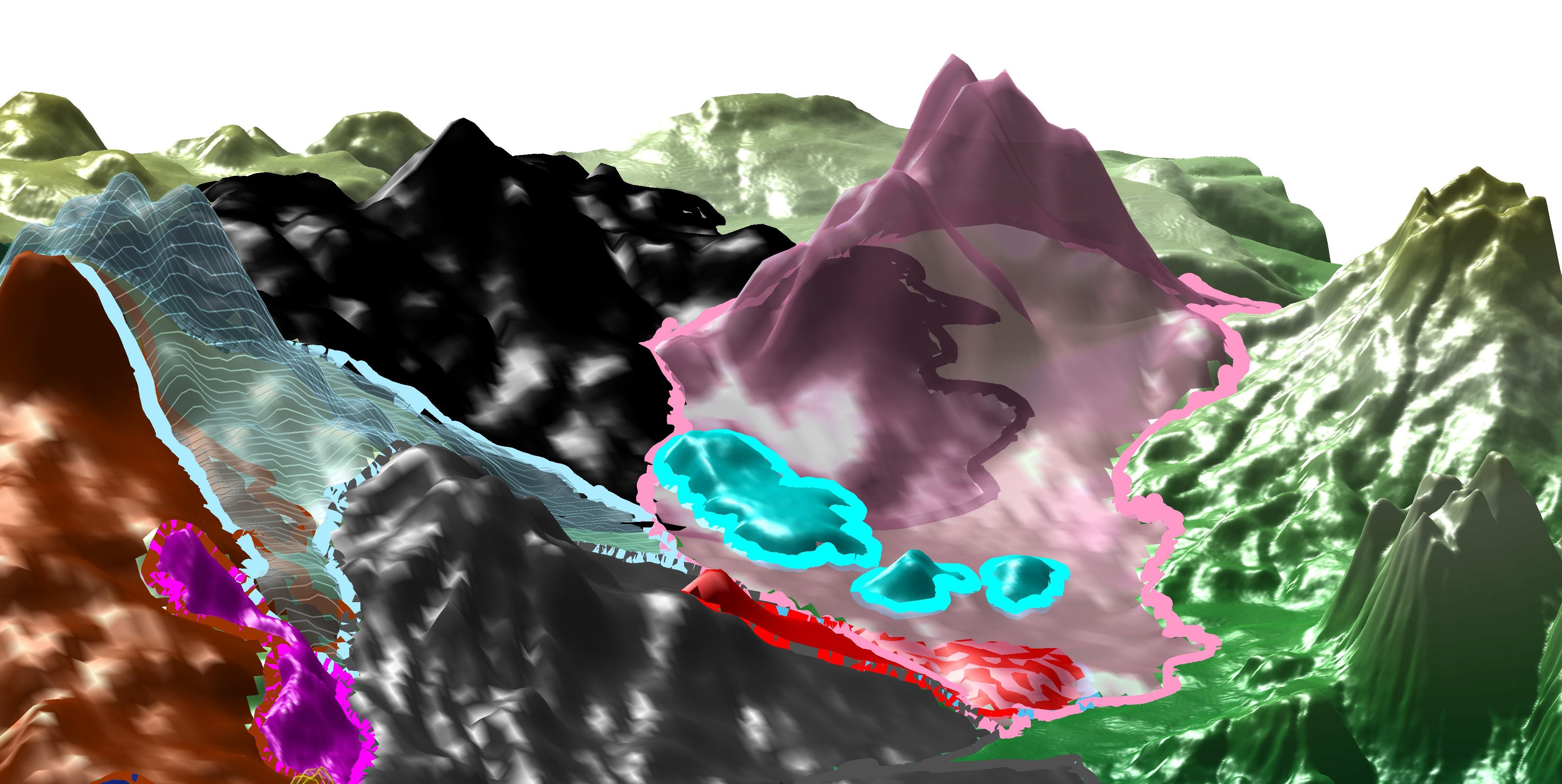
We already applied the method to several cases (paper, paper), among which an imbricated volcanic complex (La Nieve - Michoacan) for which we revealed several paleo-topographies (illustrated picture).
Download the program
The program is a compiled MATLAB executable for Windows, which will install both the MATLAB runtime (if required) and the program itself.